THE VIA EURASIA IS A CULTURAL ROUTE THAT CELEBRATES THE LINKS BETWEEN EUROPE AND THE EAST
The route highlights the footsteps of travellers and traders between the power centres of ancient empires – Rome – Constantinople, following land trade routes used by Phrygians, Lycians, Greeks, Romans, Byzantines and Ottomans. It focuses on the road system created or developed by each civilisation, with the castles or forts that defended them and the halting places where they were resupplied. It shows the walker the actual stones which travellers of old trod, the bridges they crossed, the wells or springs where they drank, the mansios or caravansarays where they slept, the markets where they traded and the places where they worshipped. The route is a symbol of unity, of the sharing of cultural values that transcend differences. It is for those with curiosity, hospitality and acceptance in their hearts.


Route development on the FIRST SECTION started in Italy – in 1994, our partner and inspiration, the Via Francigena route (Canterbury – Rome) was declared a Cultural Route by the Council of Europe, and was then upgraded in 2004 to a Major Cultural Route. It was extended southwards to Bari, then Brindisi, as the Via Francigena del sud.
Travel the route
THE VIA EURASIA CAN BE ENJOYED BY ALL KINDS OF TRAVELLERS.
Whether you are a backpacker, a day-hiker, a cyclist, a horse-rider, an explorer of local cultures and history, or an observer, the path has something to offer you. This online resource provides information and links to enable every type of traveller to explore their options and plan their own journey along the Via Eurasia.
Consider what type of traveller you are or wish to be. The Via Eurasia offers a wide variety of ways to experience the route. Understanding the options on different of the path will allow you to plan a journey exactly suited to you and your companions.
WAYS TO TRAVEL THE VIA EURASIA
Completely Independently:
Travellers who are accustomed to carrying their own packs and feel confident navigating by smart-phone apps, topographical maps or GPS. They prefer to organize their own accommodation or camp; they feel comfortable carrying food to prepare for themselves or finding local restaurants or meal options; and they utilize public transport whenever possible. They may speak some of the local languages or, if they don’t, are happy to resort to sign language or google translate. They may travel on foot or by bicycle.
Self-guided:
These hikers would like to have transport and baggage transfers arranged but navigate each day’s journey independently at their own pace. They want the freedom to choose where and when to stop and stare, to choose their own meals and places to eat. But they appreciate the security of safe baggage transfer, reserved accommodation and a helpful guide just a phone call away. At the moment, self-guided tours are only offered for walkers, not bikers.
Please fiil in this form for more information.
Organized Tours/Treks:
Cruising:
Wooden sailing/motor boats still ply the coast of Lycia and, as a change from walking, you could complete some stages of your journey by sea. Some agencies offer complete holidays combining day-trekking with living on a gület and cruising along the coast.
The current terminus of the Via Eurasia, at Demre / Myra, has a maritime association with Bari in Italy. St Nicholas (Santa Claus) was the bishop of Myra and after his death was buried in the local church. In 1192, merchants from Bari seized his bones and interred them under their new cathedral. In future, we expect our associate agencies to offer sailing holidays connecting these two ports.
Consider these possible styles of travel and decide which is most appropriate for your interests and level of fitness and experience. Once you have decided how you want to travel, you can use this website to research your journey on the Via Eurasia. You can start with your type of travel – on foot, by bike, by horse – the time you wish to go, the region you prefer or even with your favourite tour operator.
You can order guide-books and maps on line or download resources like smart-phone apps (Google Play) or Appstore.
With 4000km of route spread across 5 countries of Europe, the Balkans and Turkey, the Via Eurasia offers a variety of experiences for any type of explorer.
Festivals
An unusual way to explore the route is through local festivals which take place in villages, towns and cities along it. Some are well-developed and organized, others small, local events; they start in late May and continue through to autumn. By checking dates, you can arrange to arrive at just the right moment to join in festivities. Festivals can include religious parades, gastronomic experiences, sporting events, harvest festivals and musical performances.
When to walk
The spring starts much earlier in the Mediterranean than northern Europe, but snow still lies on mountaintops until mid-April or May. Midsummer walking is comfortable north of the Alps, but around the Mediterranean temperatures can rise to 40 degrees. Continuous hiking on the Mediterranean coast is best avoided in July-August. In most areas, autumn is warm and colourful, with fruit hanging from vines or trees.
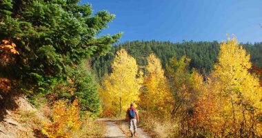
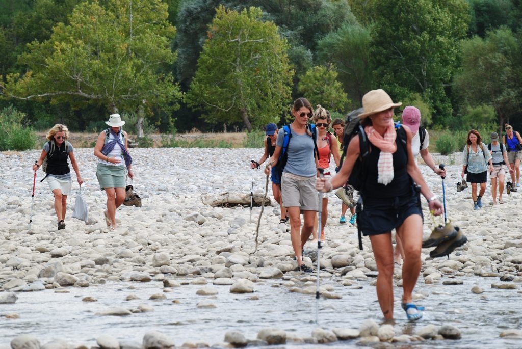
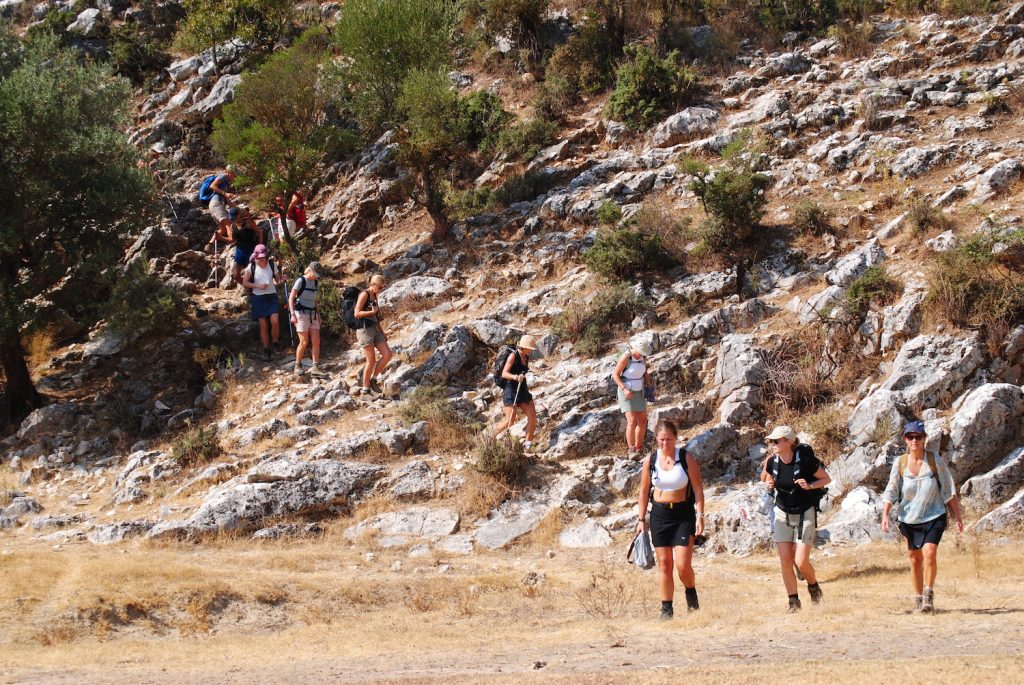
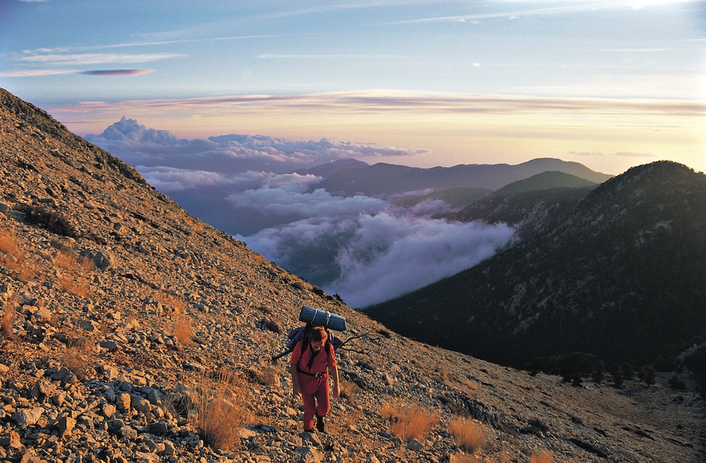
On Foot
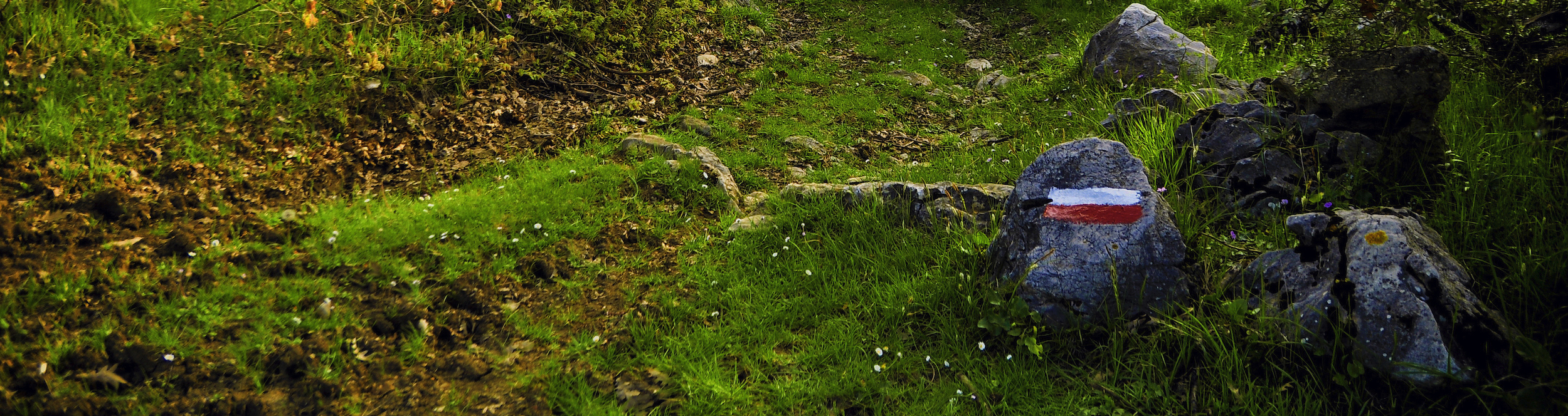
Most route users choose to travel the Via Eurasia on foot. All the routes in all countries are designed primarily for hikers and are waymarked and signposted. Route surfaces vary considerably from rural asphalt to track to ancient paved road or footpath. Daily altitude gain and loss also varies and in mountainous areas, paths can be steep. In the most-used areas, the paths are clear and easy to find, but in areas under development, signposting may not be good and routes may be overgrown. The app will guide you along the route. Independent hikers should contact us for advice.

By Bike
So far, two sections of the route are planned with bikers in mind. The Via Francigena del Sud will have a cycling route in parallel with the walking route – this is not yet complete, however. In Turkey, the Sultans Trail and the Evliya Çelebi Way can be cycled. Before you set out, please contact us for further information and alternative routes. The Mysia Ways network of Turkish routes around Bursa has a well-marked and documented cycling network. Their guide book is available from our website. Please also ask for the GPS tracks.
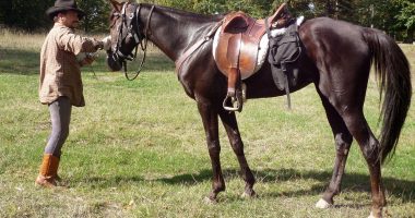
By Horse
The Evliya Çelebi Way in northern Turkey was developed for horseback, as it follows a route originally used by an Ottoman gentleman explorer riding to Mecca. It runs mainly on farm or forest tracks and old roads and uses asphalt only when tracks are not available (eg. through villages/towns). This area of Turkey is noted for its horse sports – rahvan (pacing) and cirit (a horseback javelin sport), and for local breeds of horses. Mysia Ways has two horse farms associated wit the network. The guide-book gives more information on this option as well as the biking routes.
Guide-books, maps and apps
Authorised guide books are now available for the Via Francigena in Italy, the Via Egnatia from Dürres to Thessaloniki, the Via Egnatia from Thessaloniki to the Turkish border (Greek), and the Sultans Trail (Turkish/English), the Mysia Ways (Turkish/English), the Tolerance Way (Turkish/English), the Evliya Çelebi Way, Phrygian Way, St Paul Trail and Lycian Way in Turkey. The Turkish guide books contain large 4-colour maps.
Some provinces or municipalities have produced their own local guidebooks/maps in local languages to sections of the route in their area. In this case they are mentioned on the province page and are available at the local tourism offices. These provinces include the Italian sections of the Via Francigena and sections of the route in Turkey.
In France, IGN 1:50,000 maps cover the whole of the country. In England, Ordnance Survey have 1:25,000 or 1:50,000 maps. Maps/descriptions/tracks (.gpx or .kml) of the Italian, Swiss and English parts of the Via Francigena can be downloaded from the Via Francigena website, accessed through the map pages.
Using an app:
The Via Francigena del sud app is far advanced. The CRS has developed a complete app (Via Eurasia) for the whole route between Dürres and Antalya. The Lycian Way has its own app (Lycian Way) from Antalya to Demre. GPS tracks are available for the whole route except for two linking sections in northern Turkey. You can check the latest status of the route on each province's page (accessed through the map page).
In addition, the Sultans Trail has an app which covers their whole route from Vienna to İstanbul.
These apps have detailed information including points of interest, transport details, accommodation and even water points!
The other way to follow a route is by downloading the track (.klm or .gpx file) to a mapping application. Tracks are available on the websites, by mailing us, from wikiloc or google mymaps. Remember that any tracks sourced through third party apps may not be up-to-date; the route development is so rapid that we really do not recommend using wikiloc or mymaps.
Different applications offer different base maps, but the commonest is the open source layered data set ‘open street map’ or its variant ‘open cycle map’. Alternative maps may be offered either as a chargeable extra or free; these can include open cycle map, Google roadmaps or terrain maps or Google Earth, Bing road or aerial maps, Soviet military maps or others.
You can download track file to your phone or mobile device via e-mail or Bluetooth. Once you import them into the app, the route is displayed on the map together with your position, so you can follow the route easily and accurately. Most apps work from location services so you do not need Wifi access for the service to work.
Boys (and girls) toys
It takes a lot of effort to put the routes into service. It is necessary to collect information and to coordinate between accommodation, municipalities and tourism offices. Waymarks, signposts, maps, guides and online routes need to match. If you appreciate our work, you can support us by purchasing a souvenir from the sites below. The income from the sales will be spent on the maintenance and arrangement of the roads. Via Francigena: souvenirs, t-shirts, hats etc. Turkey routes: extra maps, t-shirts etc. Traveler information (traveler ID card) (currently available only for travelers to Rome) The pilgrims credential (pilgrim identity card) is available from www.trekkinginturkey.com

